Wildfires Ravage Southern Europe and Africa: AI Innovations Aid in Tracking and Safety
During a particularly intense week in July, firefighters battled relentless wildfires across the Greek islands of Kos, Chios, and Crete. According to reports, these fires raged through the night, demanding continuous effort from the firefighting teams. Meanwhile, in the Spanish region of Extremadura, authorities activated a team of 60 personnel to control a forest fire, one of 18 threatening the area. In Cyprus, a wildfire in the Paphos region was sparked by light refracted through broken glass, according to reports. These incidents underscore a worrying trend: the area of Europe prone to wildfires has doubled in the last 50 years.
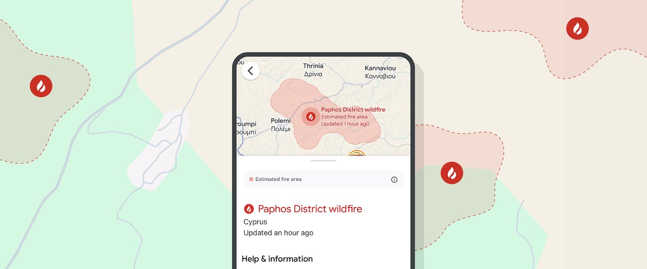
To mitigate the devastating effects of wildfires, innovative technology is playing a crucial role. Using artificial intelligence (AI), detailed wildfire boundary tracking is now available through Google Search and Maps, as well as via location-based push notifications. This advanced tool, initially deployed in a limited capacity, is now being expanded to 15 countries across Europe and Africa during this record-breaking summer.
Countries Benefiting from AI-Powered Wildfire Tracking
The countries where this AI-powered wildfire tracking tool is now available include:
- Andorra
- Bosnia & Herzegovina
- Croatia
- Cyprus
- France
- Greece
- Italy
- Kenya
- Monaco
- Montenegro
- Portugal
- Rwanda
- Slovenia
- Spain
- Türkiye
This expansion aims to provide real-time information and safety alerts to people in wildfire-prone regions, potentially saving lives and mitigating property damage.
Accurate and Reliable Tracking
Google’s AI-powered model for wildfire tracking is built on multiple data sources, including various satellite imagery datasets. The model’s accuracy is validated by comparing it with fire scars—shapes determined after a fire has been contained—based on measurements from past wildfire events. Additional AI models are employed to verify the existence of fires, creating a comprehensive system that provides more accurate and definitive wildfire boundaries than satellite imagery alone.
Making Information Accessible and Useful
As this new capability was rolled out over the summer, Google mapped over 40 wildfires in southern Europe, including significant fires in Spain, Greece, and Cyprus. The tool also mapped wildfires in other regions, from Portugal to Kenya, demonstrating its wide-reaching applicability and effectiveness.
The Growing Threat of Wildfires
The increasing frequency and intensity of wildfires are a growing concern globally, particularly in Europe and Africa. Climate change has been identified as a significant factor contributing to this trend. Rising temperatures and prolonged dry periods create ideal conditions for wildfires, making regions more susceptible to such disasters. The expansion of fire-prone areas in Europe over the past five decades highlights the urgent need for effective monitoring and response strategies.
The Role of Technology in Combating Wildfires
The integration of AI and satellite imagery in wildfire tracking represents a significant advancement in disaster management. By providing real-time data and predictive modeling, these technologies enable quicker responses and more efficient resource allocation. For example, firefighters can use this information to prioritize areas that need immediate attention, while residents can receive timely alerts to evacuate or take precautionary measures.
Community Involvement and Preparedness
While technology plays a critical role, community involvement and preparedness are equally important. Public awareness campaigns and educational programs can help residents understand the risks and take necessary precautions. Simple actions, such as creating defensible spaces around properties and having evacuation plans in place, can significantly reduce the impact of wildfires.
The Importance of Global Cooperation
Addressing the wildfire crisis requires global cooperation. Sharing data, resources, and best practices can enhance the effectiveness of wildfire management strategies. International organizations, governments, and private entities must work together to develop and implement comprehensive plans to combat this growing threat.
Looking Ahead
As we move forward, the integration of advanced technologies like AI in disaster management will continue to evolve. The success of initiatives like Google’s AI-powered wildfire tracking tool demonstrates the potential of such technologies to make a real difference. However, it is essential to continue investing in research and development to improve these tools and ensure they remain effective in the face of changing climate conditions.
Conclusion
The recent wildfires in Greece, Spain, and Cyprus serve as a stark reminder of the growing threat posed by climate change. The expansion of AI-powered wildfire tracking to 15 countries across Europe and Africa is a significant step forward in mitigating the impact of these disasters. By providing accurate, real-time information and safety alerts, this technology can help save lives and protect property. However, addressing the wildfire crisis requires a multifaceted approach that includes technological innovation, community involvement, and global cooperation. Together, we can develop effective strategies to combat this growing threat and ensure a safer future for all.
For more Information, Refer to this article.


