Curiosity Rover’s Martian Journey: Navigating a Rocky Terrain
The Curiosity Rover, a marvel of modern science and engineering, continues its bold mission on the Martian surface. Managed by NASA’s Jet Propulsion Laboratory, this rover has been exploring the Red Planet for over a decade, providing invaluable insights into Martian geology and climate. As of Sols 4341-4342, Curiosity faced a challenging path, shedding light on both the technical intricacies involved in maneuvering the rover and the scientific discoveries being made.
The Current State of Exploration
As of October 21, 2024, the Curiosity team was in full swing, meticulously planning the rover’s next moves. This involved a detailed understanding of the Martian terrain, which is characterized by uneven surfaces and sharp, angular rocks. Such conditions can pose significant challenges for navigation, requiring the team to be both strategic and cautious.
On Earth, the team operates within a specific time offset that allows them to plan activities for two Martian days—or sols—at a time. During this period, the team carefully orchestrates the rover’s movements, ensuring its safety while maximizing scientific output.
Scientific Endeavors
The first sol of this planning cycle was packed with scientific activities. Curiosity’s suite of instruments was put to good use, starting with remote sensing tasks. The ChemCam, a sophisticated instrument capable of analyzing chemical compositions from a distance, was employed. It conducted a joint observation with the Mastcam, another integral tool, focusing on a target named "Ewe Lake." The objective was to discern variations in the rock’s layers, a clue to understanding the planet’s geological history.
Additionally, the team targeted "Olmstead Point" for further analysis. This area appeared darker than its surroundings, prompting the use of ChemCam’s Remote Micro-Imager (RMI) and Mastcam to explore potential chemical differences. Such observations are crucial for piecing together Mars’ environmental and geological narrative.
Curiosity also captured stereo images of "Depressed Lake," aiming to determine whether this loose rock block is part of the Stimson or Sulfate units. These units represent different geological periods, and identifying their presence helps scientists construct a timeline of Martian history.
Contact Science and Mobility Planning
After a brief period of inactivity for energy conservation, Curiosity resumed its tasks. The focus shifted to "Chuck Pass," an intriguing piece of bedrock featuring unique laminations and nodules. Here, the rover conducted a series of analyses, including DRT (Dust Removal Tool) brushing, MAHLI (Mars Hand Lens Imager) imaging, and APXS (Alpha Particle X-ray Spectrometer) measurements. These tools allow for close examination of rock surfaces, providing insights into their composition and formation processes.
With the arm stowed, Curiosity prepared for its next drive. The second sol’s activities began with additional remote sensing, revisiting "Chuck Pass" with ChemCam and Mastcam to gather more data. The ChemCam RMI also captured images of the area east of "Whitebark Pass" to gain a new perspective on the white sulfur stones scattered below.
Atmospheric observations were also on the agenda. These included monitoring dust movement on the rover’s deck and conducting a large dust devil survey. Such observations contribute to understanding Martian weather patterns and their impact on the surface.
Navigating a Rocky Terrain
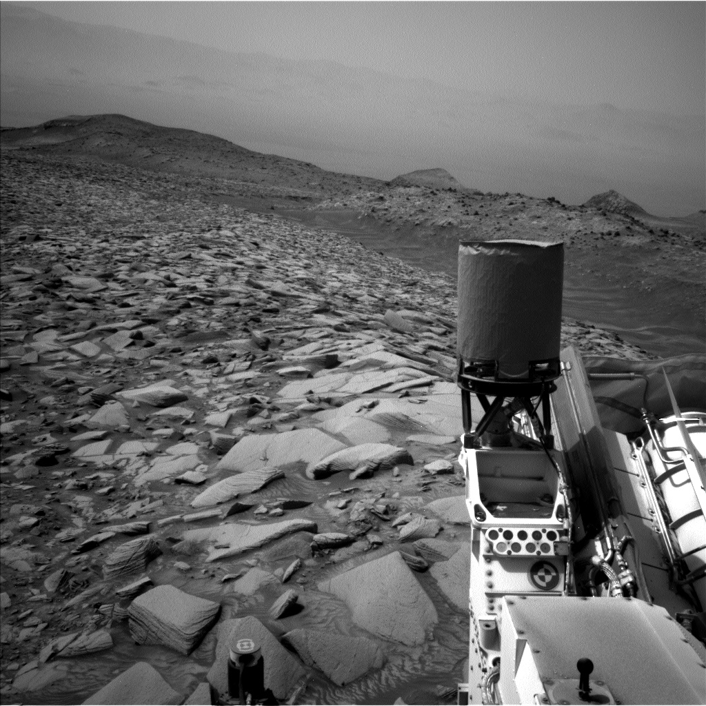
The driving phase of the mission presented its own set of challenges. The terrain, though not steep, was notably rocky, complicating the navigation process. The team had to ensure that the rover avoided large or sharp rocks that could damage its wheels. This required careful planning to prevent the wheels from scraping against or getting wedged in the rocks.
Moreover, the rocky terrain limited the availability of stereo data, as the rocks obstructed the rover’s view. Consequently, the team had to rely on additional frames to find the safest and most efficient path for the rover’s journey.
Another layer of complexity was added by the need to drive the rover backward. This maneuver was necessary to ensure Curiosity maintained a clear line of sight with Earth, allowing for uninterrupted communication. When driving backward, the rover’s hardware can block its view, necessitating careful adjustments to maintain visibility.
Despite these hurdles, the team successfully navigated the rover approximately 32 meters (about 105 feet) along a safe path, circumventing a steering hazard and progressing towards the next significant imaging site. Post-drive imaging included a twilight MARDI (Mars Descent Imager) photograph, capturing the terrain in the fading light.
Reflections on the Mission
Curiosity’s continuous journey across the Martian landscape is a testament to human ingenuity and the spirit of exploration. Each sol presents new challenges and opportunities for discovery, advancing our understanding of a planet that has long intrigued scientists and the public alike.
The successes of the Curiosity mission lay the groundwork for future explorations. With each maneuver and each scientific observation, we move closer to unraveling the mysteries of Mars, paving the way for potential human missions and deepening our knowledge of the cosmos.
For those interested in delving deeper into the Curiosity mission and its findings, NASA’s website offers a wealth of resources and updates. Explore more at NASA’s Curiosity Mission.
For more Information, Refer to this article.


