Advancements in NASA’s Airborne Technology: Enhancing Wildland Fire Management
In a groundbreaking move, NASA has been leveraging advanced airborne technology to enhance our understanding of wind patterns and their impact on smoke and fire behavior. These technological advancements hold the potential to revolutionize how agencies make critical decisions in managing wildfires. By providing precise data, these tools can significantly improve the allocation of firefighters and resources during wildland fire incidents. A dedicated team from NASA’s Armstrong Flight Research Center, located in Edwards, California, is at the forefront of demonstrating the capabilities of these technologies.
Innovative Instruments: Pioneering Fire Management
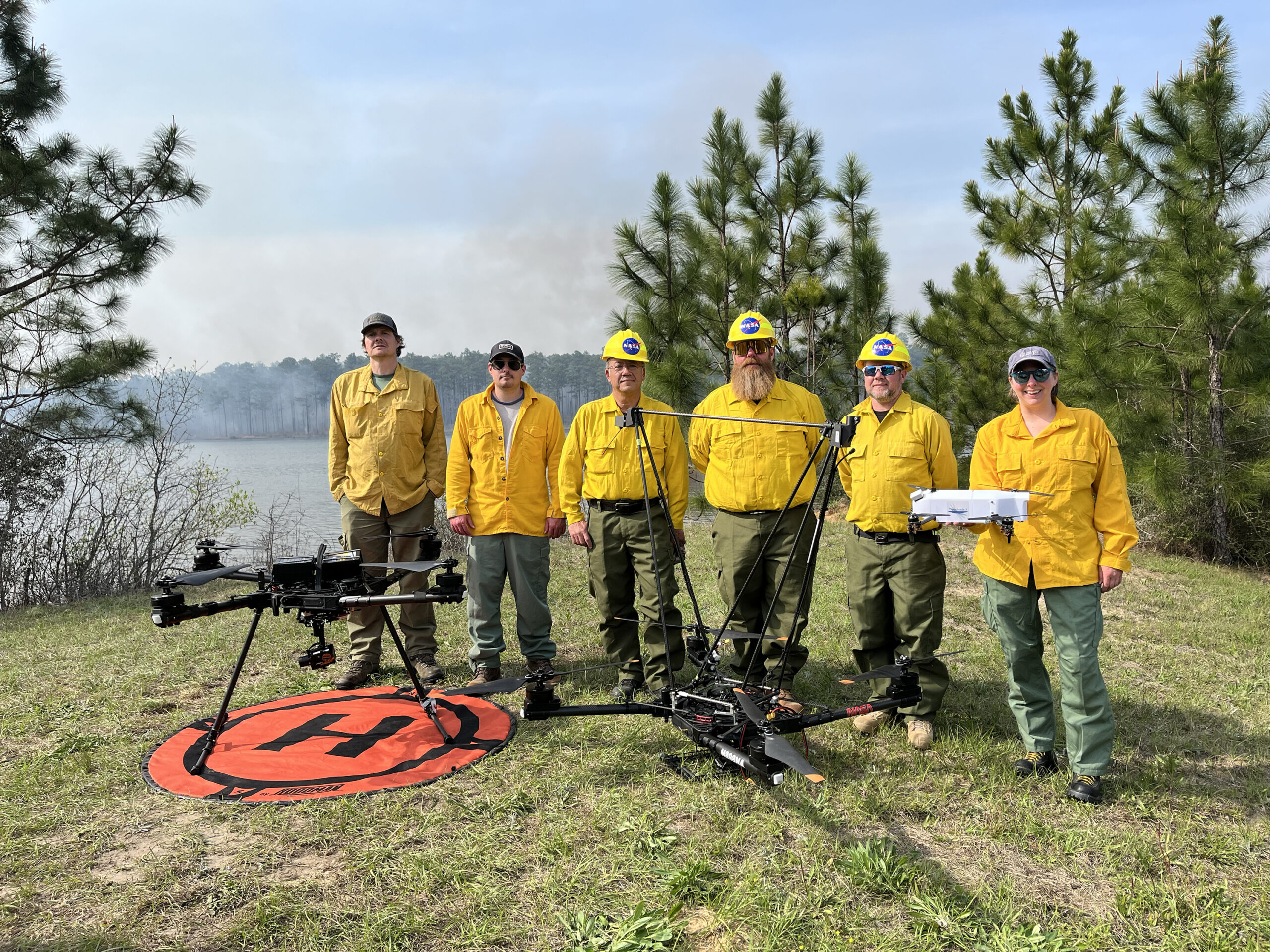
Two cutting-edge instruments from NASA’s Langley Research Center in Hampton, Virginia, have been instrumental in this endeavor. The first is a sophisticated sensor designed to collect three-dimensional wind data. The second is a radiosonde, a device that measures essential atmospheric parameters such as temperature, barometric pressure, and humidity. These instruments were mounted on NASA Armstrong’s Alta X drone, which was used in a prescribed burn at Geneva State Forest. Situated approximately 100 miles south of Montgomery, Alabama, this forest served as a testing ground for these technologies. The initiative is part of NASA’s multi-year FireSense project, which aims to develop and refine technologies that could support the U.S. Forest Service and other local, state, and federal wildland fire agencies.
Jennifer Fowler, the FireSense project manager, emphasized the objectives of the Alta X portion of the project. "The mission includes a technical demonstration for wildland fire practitioners and the collection of data at various altitudes to support the Alabama Forestry Commission’s operations," Fowler stated. She highlighted the importance of gathering information at different altitudes to monitor the variables involved in a prescribed burn.
Key Variables in Fire Management
One of the critical variables in fire management is the mixing height, which refers to the vertical extent or depth to which smoke can disperse. According to Fowler, predicting the mixing height is challenging but crucial. Additionally, humidity levels must exceed 30% for a prescribed burn to proceed safely. Traditionally, such localized data collection has been inaccessible in wildland fire operations, underscoring the significance of the Alta X drone and its instruments in demonstrating the potential of prescribed burn technology.
Aerial Missions: Gathering Crucial Data
In addition to the Alta X flights that commenced on March 25, NASA Armstrong’s B200 King Air aircraft played a vital role in the mission. This aircraft flew over actively burning fires at an altitude of roughly 6,500 feet. Meanwhile, other aircraft involved in the mission operated at lower altitudes during the fire and at higher altitudes before and after the fire to gather necessary data. This multi-agency mission aims to provide comprehensive data to validate and refine the prescribed burn forecast model.
Uncrewed Aircraft System Pilots: Behind the Scenes
The successful execution of this mission involved the expertise of small, uncrewed aircraft system pilots from NASA Armstrong. The team, comprising Derek Abramson, chief engineer for the subscale flight research laboratory; Justin Hall, NASA Armstrong’s chief pilot of small, uncrewed aircraft systems; and Alexander Jaffe, a skilled drone pilot, meticulously prepared for the research flights in Alabama. Their responsibilities included setting up, flying, and observing the airborne operations, all while ensuring that additional aircraft batteries remained charged. The launch and recovery of the Alta X are conducted manually, while the mission profile is flown autonomously to guarantee consistent conditions for data collection.
Understanding the Flight Profile
Derek Abramson explained the flight profile of the mission, describing it as vertical, with the drone ascending and descending straight up and down from the surface to an altitude of approximately 3,000 feet. "Our goal is to characterize the mixing height and track changes in moisture, mapping out how these factors evolve throughout the day in connection with the burn," Abramson elaborated.
Expanding Horizons: A Look into the Future
In August 2024, a team of NASA researchers conducted a successful demonstration of the FireSense project drone technology in Missoula, Montana. Utilizing the NASA Langley Alta X and weather instruments, the team generated localized forecasts that provided precise and sustainable meteorological data. This data was crucial in predicting fire behavior and assessing smoke impacts, further underscoring the potential of these technologies in enhancing fire response capabilities.
Conclusion: A Promising Path Forward
NASA’s advancements in airborne technology represent a significant step forward in the field of wildland fire management. By providing localized data on wind patterns and atmospheric conditions, these technologies empower agencies to make informed decisions, optimize resource allocation, and enhance the safety and efficiency of fire management operations. As NASA continues to refine and expand its FireSense project, the potential for these technologies to transform how we approach wildland fire management becomes increasingly apparent.
For more information on NASA’s FireSense project and its ongoing efforts to advance fire management technologies, please visit NASA’s FireSense website.
In conclusion, the integration of cutting-edge technology into wildland fire management holds immense promise. As we continue to face the challenges posed by wildfires, initiatives like NASA’s FireSense project provide valuable insights and tools that can help mitigate the impact of these natural events. By harnessing the power of technology, we can work towards safer and more effective fire management practices, ultimately safeguarding both lives and ecosystems.
For more Information, Refer to this article.


