Mastcam’s Weekend Imaging Plans: Capturing Martian Landscapes
This weekend, the Mars rover, equipped with the Mast Camera (Mastcam), is set to capture a series of detailed images of the Martian landscape. This initiative is aimed at gathering more data about the planet’s surface and geological features, thanks to an extra boost of energy akin to a sugar rush from Halloween sweets!
Close-range Imaging Targets
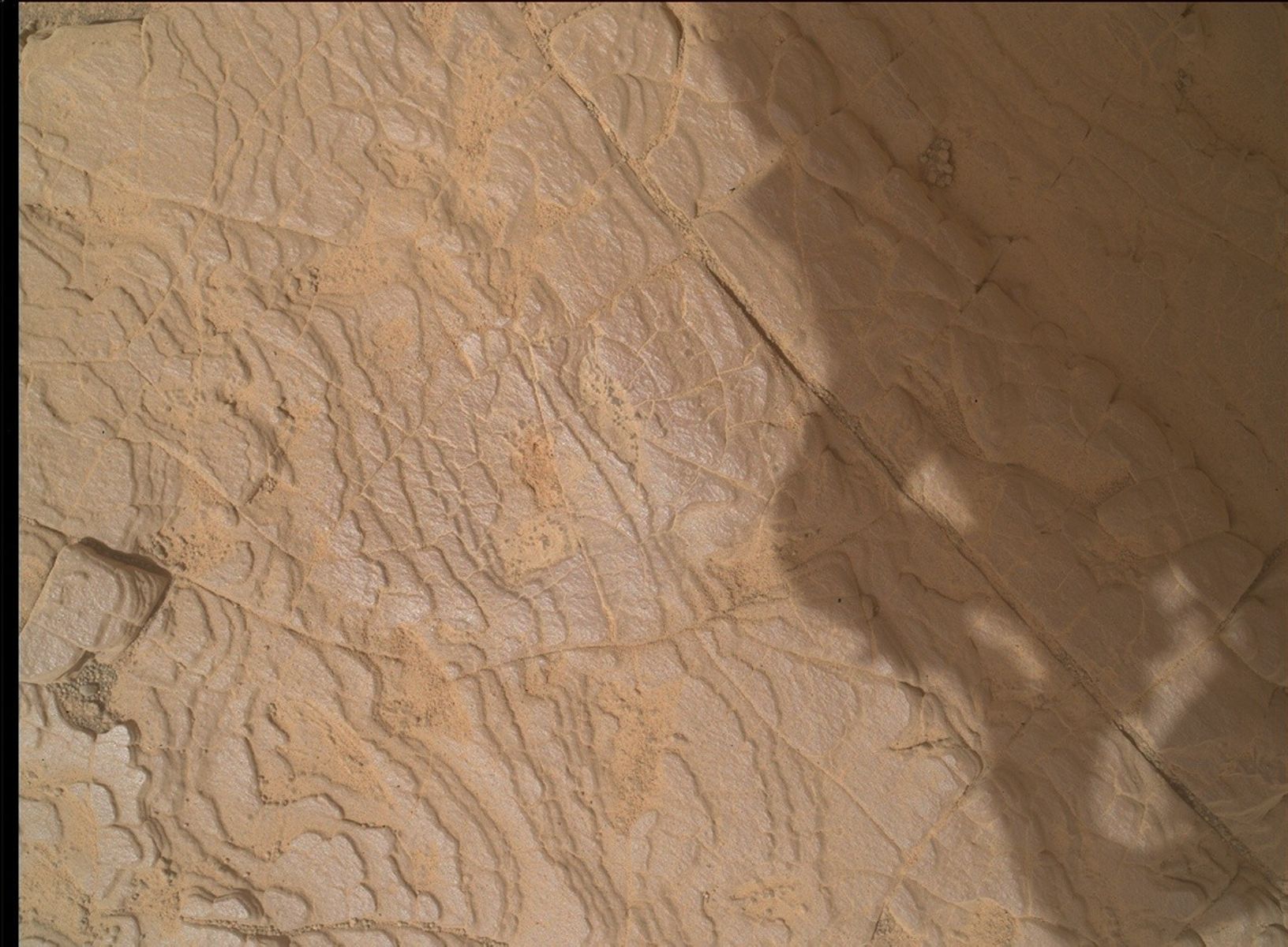
The Mastcam will first focus on capturing single-frame images of two nearby geological targets: Hoist Ridge and Eureka Valley. These areas are of interest because they provide valuable insights into the composition and formation of the Martian terrain. Understanding these features can help scientists make informed predictions about the planet’s geological history and potential for past life.
Additionally, Mastcam will create a small mosaic of images featuring some surface troughs located just a bit further from the rover. These troughs are linear depressions that could tell us more about the erosional processes or tectonic activities on Mars.
Expanding the Horizon: Wide-range Mosaics
Moving beyond the immediate vicinity, Mastcam will undertake a small 3×1 mosaic, which involves stitching together three images in a single row. This mosaic will cover the same area as the ChemCam Remote Micro-Imager (RMI) on the Gediz Vallis ridge. The Gediz Vallis ridge is particularly intriguing due to its complex geological structures, which might have formed from volcanic or fluvial processes.
In addition to this, Mastcam will also capture a larger 9×2 mosaic of the distant yardang unit. Yardangs are streamlined wind-eroded ridges that provide valuable clues about the climatic conditions and wind patterns on Mars over extended periods. The hope is to reach this area in the coming years for more detailed exploration and study.
Decoding Technical Jargon
For those not familiar with some of the technical terms used, here’s a brief explanation:
- Mastcam: This is a camera system on the Mars rover, designed to take high-resolution images and videos of the Martian surface. It helps scientists study the planet’s terrain and atmosphere.
- Mosaic: In this context, a mosaic refers to a composite image made by combining several smaller images. It allows for high-resolution and wide-area coverage of the landscape, providing a comprehensive view of the target area.
- ChemCam RMI: The ChemCam Remote Micro-Imager is a part of the rover’s chemistry and camera suite. It is used to capture detailed images of distant objects, which helps in analyzing the composition of Martian rocks and soil.
- Yardang: A yardang is a geological formation created by wind erosion. These streamlined ridges can reveal past environmental conditions on Mars.
Importance of These Imaging Efforts
These imaging efforts are crucial for expanding our understanding of Mars. By studying these images, scientists can gain insights into the planet’s past environment, which is essential for assessing its habitability and potential for past life. The captured images will help build a detailed map of the Martian surface, aiding future exploration missions.
The Road Ahead: Future Exploration
The larger 9×2 mosaic of the yardang unit not only provides immediate scientific value but also sets the stage for future exploration. As the rover continues its journey, reaching this distant area in the coming years could unlock more secrets about Mars’ climatic history and geological evolution.
Good to Know: Mars Rover’s Imaging Capabilities
The Mars rover’s imaging capabilities extend beyond just capturing stunning visuals. These images are integral to scientific research, allowing scientists to:
- Analyze rock formations and soil samples remotely.
- Identify potential drilling sites for collecting samples.
- Monitor weather patterns and atmospheric conditions.
- Study the effects of wind and erosion over time.
Conclusion
The ongoing efforts of the Mars rover and its Mastcam to capture detailed images of Martian landscapes are pivotal in our quest to understand our neighboring planet better. These images not only enhance our knowledge of Mars but also pave the way for future missions that could one day include human exploration.
For more detailed insights and updates on the Mars rover’s activities, you can visit the official NASA Mars exploration website.
For more Information, Refer to this article.


