Garmin Unveils Advanced Montana Handheld GPS Series for Outdoor Enthusiasts
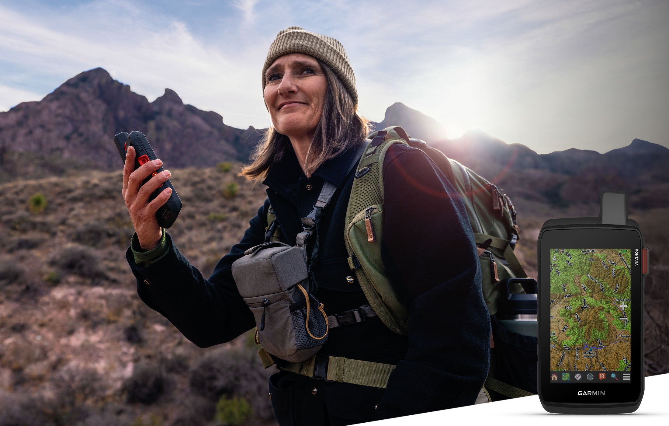
Garmin, a leader in GPS technology, has introduced a new lineup of handheld GPS devices designed to meet the needs of outdoor adventurers. The latest Montana series includes the Montana 710, Montana 710i, and the Montana 760i. These rugged devices are equipped with easy-to-read 5-inch color touchscreens that are compatible with gloves, making them suitable for use during various outdoor pursuits such as hiking, mountain biking, and off-road riding. Additionally, the devices can be mounted on ATVs, boats, cars, motorcycles, RVs, and other vehicles, with mounts sold separately.
The new Montana series comes preloaded with TopoActive maps that provide detailed information about terrain contours, elevations, coastlines, rivers, and landmarks. This feature ensures that adventurers can confidently navigate through diverse landscapes. The Montana 710i and 760i models also incorporate Garmin’s inReach technology, allowing users to communicate via satellite even when far from cellular networks. This technology provides two-way text messaging and location tracking using the global Iridium satellite network. In case of an emergency, the devices can send an interactive SOS message to the Garmin Response center, which is staffed 24/7 to coordinate international emergency assistance.
Garmin’s Vice President of Global Consumer Sales, Dan Bartel, expressed enthusiasm for the new series, stating that the Montana series is designed to guide users and keep them connected, even in remote areas without cellular service. The built-in TopoActive maps, touchscreen displays, and extended battery life offer adventurers the confidence to explore beyond their usual limits. The optional inReach technology ensures that users can stay in touch with loved ones during their journeys.
Exploring with Confidence
The Montana series is packed with advanced mapping and navigation features to support a wide range of outdoor activities:
TopoActive Maps: These preloaded maps offer worldwide topographical information optimized for outdoor activities. They include details such as terrain contours, summits, and coastlines.
Satellite Imagery: Users can access high-resolution satellite imagery directly on their devices via Wi-Fi, providing photorealistic overhead views of routes and surrounding areas. This feature allows adventurers to create waypoints based on visible landmarks.
Federal Public Land Boundaries: An optional overlay on topographic maps displays public and private land boundaries, helping ensure that users stay on the intended path.
City Maps: The devices offer seamless transitions from trails to roads with turn-by-turn directions using preloaded City Navigator mapping, available on the Montana 710i and 760i models.
Trip Planning: The Garmin Explore smartphone app allows users to plan and review trip data, manage waypoints, and organize courses and activities.
Outdoor Maps+: With an Outdoor Maps+ subscription (sold separately), users gain access to premium mapping content, including elevation contours, land boundaries, and wildlife areas. Regular updates can be downloaded via Wi-Fi.
Expanded Memory: The devices come with 32 GB of onboard memory, allowing users to download additional maps such as BlueChart g3 for water navigation (sold separately).
Navigation Sensors: Built-in sensors include an altimeter for elevation data, a barometer for monitoring weather changes, and a three-axis electronic compass for precise navigation.
Multi-GNSS Support: The devices support both GPS and Galileo satellite networks, offering enhanced accuracy in challenging environments.
Durability and Design
The Montana series is engineered to withstand harsh outdoor conditions. It has been tested to meet U.S. military standards for thermal, shock, and vibration resistance (MIL-STD-810) and features an IPX7 water resistance rating. The devices are powered by a rechargeable lithium-ion battery that lasts up to 24 hours in GPS mode and up to 440 hours in expedition mode. Recharging is convenient with a standard USB-C cable.
The Montana 760i model also features an 8-megapixel camera, allowing users to capture photos during their adventures. The device automatically geotags images with coordinates, making it easy for users to revisit their favorite locations.
The Montana 710, 710i, and 760i GPS handhelds are now available, with prices ranging from $649.99 to $899.99. For more information, visit Garmin’s website at garmin.com/outdoor.
Garmin’s Commitment to Innovation
Garmin is renowned for its innovative products that enhance the experiences of adventurers, athletes, and outdoor enthusiasts worldwide. The company is committed to developing technology that enriches lives and provides peace of mind. With each new release, Garmin continues to push the boundaries of what is possible, offering users the tools they need to explore with confidence.
Understanding Technical Jargon
For those unfamiliar with some of the technical terms used in the article:
TopoActive Maps: These are detailed topographic maps that show physical features of the landscape such as hills and valleys, which are useful for outdoor navigation.
inReach Technology: This refers to satellite communication technology that enables messaging and tracking when outside cellular service areas.
Multi-GNSS Support: Global Navigation Satellite Systems (GNSS) are networks of satellites that provide positioning data. Multi-GNSS means the device can access more than one network, improving accuracy.
IPX7 Rating: This is a standard for water resistance, indicating that the device can withstand immersion in water up to 1 meter deep for 30 minutes.
MIL-STD-810: A set of military standards for testing equipment durability under various environmental conditions.
Conclusion
Garmin’s latest Montana series represents a significant advancement in handheld GPS technology, catering to the needs of outdoor enthusiasts who require reliable navigation and communication tools. With its robust design, comprehensive mapping features, and satellite communication capabilities, the Montana series is set to be an essential companion for adventurers seeking to explore uncharted territories. For more details on these innovative devices, visit Garmin’s official website.
For more Information, Refer to this article.


