In late 2022, the Western United States found itself grappling with a severe drought that had persisted for over two decades, particularly impacting the Colorado River Basin. This prolonged dry spell had drawn significant attention globally due to its severe implications on water resources in the region. However, as we embarked on a new year, the narrative shifted dramatically. By early 2023, California was facing unexpected flooding, with 68% of the state experiencing little to no drought conditions. This sudden change in weather patterns prompted a pause during a video interview with Forrest Melton, NASA Project Scientist for OpenET, when a tree fell outside his Bay Area home due to heavy rains.
Melton, who also serves as the Associate Program Manager for agriculture and water resources with NASA’s Earth Action program, expressed skepticism about the longevity of the wet conditions. California’s climate is characterized by extreme swings between drought and flood, as exemplified by the 2016/17 winter which saw significant rainfall followed by years of dry conditions. Despite the heavy rains in early 2023, Melton emphasized that a single wet winter is insufficient to replenish the groundwater across the Western United States, as indicated by NOAA’s National Integrated Drought Information System. Groundwater levels, particularly in California’s Central Valley and the Ogallala Aquifer, continue to decline, underscoring the critical need for improved water management solutions.
Enter OpenET, a groundbreaking online platform designed to provide satellite-based evapotranspiration (ET) data to the public. This initiative, described by Melton as offering invaluable and scientifically robust data, supports both day-to-day decision-making and long-term planning in water management. But what exactly is evapotranspiration? It is the combined process of evaporation and transpiration—evaporation refers to water turning into vapor from surfaces like soil or water bodies, while transpiration involves water vapor escaping from plant tissues through tiny pores known as stomata. Although this process occurs almost constantly, it’s challenging to measure on the ground due to water vapor’s invisibility.
To better understand evapotranspiration’s impact, consider a decorative fountain. Typically, fountains recycle the same water. As water circulates, some of it evaporates from the surface, while plants like lily pads might use and lose water through transpiration. The total water lost through these processes constitutes evapotranspiration, representing consumptive water use since it cannot be reused. Monitoring evapotranspiration reveals how much water is depleted from a local system, allowing for better management of water resources to maintain a balance between supply and demand.
The OpenET project aims to fill the gap left by traditional evapotranspiration measurement methods, which are often expensive and limited in scope. Traditionally, ET data was collected using instruments like weighing lysimeters and eddy covariance systems, but these methods are costly and only provide localized data. OpenET leverages decades of research funded by NASA, USDA, and USGS to utilize satellite data from programs like Landsat. By combining satellite imagery with weather data, OpenET calculates ET rates and volumes for every quarter-acre of land, offering a comprehensive view of water use.
This data is accessible through OpenET’s Data Explorer, a free web tool that allows users to visualize evapotranspiration data across the Western United States. The platform’s user-friendly interface was developed with input from water managers and farmers, ensuring its practicality and relevance. Users can explore ET trends over time, helping them understand seasonal and annual variations in water use. The OpenET consortium, comprising NASA, USGS, USDA, and numerous academic and environmental organizations, has made significant contributions to the development of this tool.
The accuracy of OpenET’s models is crucial for their utility, and a recent study led by John Volk of the Desert Research Institute assessed the accuracy of satellite-based ET data by comparing it to ground measurements at over 150 sites across the U.S. The study found that an ensemble value derived from multiple ET models provided the most reliable results. The findings, published in Nature Water, emphasized the importance of making the data publicly available to build trust and encourage widespread use.
OpenET has already made a significant impact in California, particularly in the Sacramento-San Joaquin Delta, a critical water resource area. Here, farmers faced challenges with traditional water measurement methods, which were costly and difficult to maintain. By utilizing OpenET data, farmers developed an alternative compliance plan for water use reporting, streamlining the process and reducing costs. This innovative approach, known as the Delta Alternative Compliance Plan (Delta ACP), allows farmers to estimate their water usage using satellite data, saving time and resources.
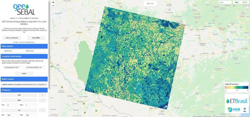
The success of OpenET in California highlights its potential for broader application, particularly in regions facing water scarcity. The platform’s first international partnership is underway in Brazil, where Professor Anderson Ruhoff and his team are adapting OpenET for their country’s unique environmental conditions. This collaboration aims to enhance the accuracy and applicability of ET data globally, demonstrating the potential for international expansion.
Water scarcity is a growing concern worldwide, and tools like OpenET offer a promising solution by making water usage more visible and manageable. As we face the challenges of climate change and increasing demand for water resources, platforms like OpenET provide critical data to support sustainable water management practices. For more information about OpenET, visit their official website at https://etdata.org/.
For more Information, Refer to this article.


