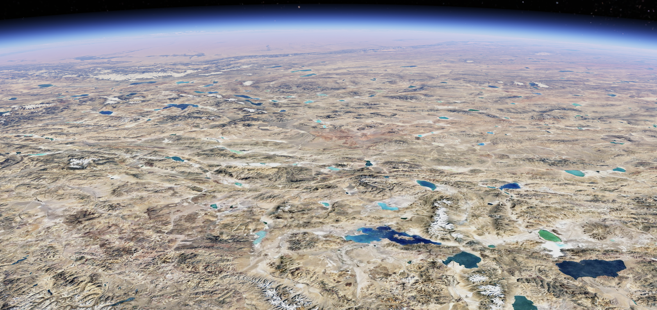
In addition to helping you browse Earth’s changes, we’re also making it easier for researchers and organizations to use Google Earth for projects, like creating custom maps. Soon, we’ll start showing projects right from a newly designed home screen in Google Earth, making it even easier to collaborate with your teams. You can learn more about these updates on our developer blog.
Expanding Street View Imagery in Nearly 80 Countries
While Google Earth has a vast repository of satellite and aerial imagery, Street View displays over 280 billion images collected from our Street View cars and trekkers. With Street View, you can virtually explore every continent right from your living room — and even places like the Great Barrier Reef and the International Space Station. Now, we’re launching one of the biggest updates to Street View yet, with new imagery in almost 80 countries — some of which will have Street View imagery for the very first time.
You’ll be able to explore the picturesque countryside of Bosnia and its medieval villages, the sandy mountains surrounding the capital of Namibia, the alps and castles of Liechtenstein, and the beautiful rivers of Paraguay. You can even virtually wander the streets of foreign cities to see shops and buildings up close.
—
Google Earth Enhancements for Research and Collaboration
Google Earth is not just a tool for casual exploration; it has evolved into a powerful platform for researchers and organizations aiming to create custom maps and projects. The upcoming update will introduce a newly designed home screen within Google Earth, which will prominently feature various projects. This redesign aims to facilitate easier collaboration among team members, making it simpler to share and develop ideas collectively.
For those unfamiliar with Google Earth, it is a virtual globe, map, and geographical information program that provides a comprehensive view of our planet. Researchers use it to visualize data, create interactive maps, and conduct spatial analysis. The new home screen will streamline these processes, ensuring that projects are easily accessible.
Street View: A Window to the World
Street View is another remarkable feature of Google Earth, offering over 280 billion images from across the globe. These images are captured by Google’s Street View cars and trekkers, providing users with immersive, 360-degree views of streets, landmarks, and even underwater and space locations. The latest update will expand Street View’s reach to nearly 80 countries, some of which are receiving this feature for the first time.
For instance, users can now explore the serene countryside of Bosnia, complete with its medieval villages. Namibia’s sandy mountains and the alps and castles of Liechtenstein are also part of this update. Paraguay’s beautiful rivers and various other picturesque landscapes are now just a click away. This expansion not only enhances virtual tourism but also serves educational purposes, allowing students and researchers to study different parts of the world from their own homes.
The Technical Marvel Behind Street View
Street View’s operation is a technical marvel. The imagery is collected using specialized cameras mounted on cars and trekkers. These cameras capture panoramic photos, which are then stitched together to create a seamless, interactive experience. The data is processed using advanced algorithms to ensure high-quality images and accurate geographical representation.
For those curious about the technical jargon, a "trekker" is a portable camera system that can be worn by an individual or mounted on various vehicles. This allows Google to capture images in places inaccessible by car, such as narrow streets, hiking trails, and even underwater locations like the Great Barrier Reef. The data collected is then integrated into Google Earth’s platform, providing users with an interactive way to explore these unique locations.
Educational and Practical Applications
The expansion of Street View and enhancements in Google Earth have significant educational and practical applications. Educators can use these tools to create interactive lessons, allowing students to explore historical sites, natural wonders, and urban landscapes from their classrooms. Researchers can visualize geographical data in a more intuitive way, aiding in environmental studies, urban planning, and more.
Organizations can also benefit from these updates. Custom maps can be created for various projects, such as planning logistics for large-scale events, conducting market research, or even disaster response planning. The newly designed home screen in Google Earth will make it easier for teams to collaborate, ensuring that everyone has access to the latest information and can contribute effectively.
User Reactions and Reviews
The response to these updates has been overwhelmingly positive. Users appreciate the enhanced accessibility and the new features that make exploration and research simpler. The educational community, in particular, has praised the updates for making it easier to create engaging, interactive lessons. Researchers and organizations have also expressed their approval, noting that the new tools will significantly aid in their work.
Future Prospects
Looking ahead, Google Earth and Street View are poised to become even more integral to various fields. With continuous updates and improvements, these tools will offer increasingly detailed and accurate representations of our world. Future updates may include more real-time data integration, augmented reality features, and even more comprehensive global coverage.
Conclusion
The latest updates to Google Earth and Street View mark a significant step forward in virtual exploration and geographical research. With new imagery from nearly 80 countries and a redesigned home screen for easier project collaboration, these tools are more powerful and user-friendly than ever. Whether you’re an educator, researcher, or just someone who loves exploring new places, these enhancements offer something for everyone.
For more detailed information, you can visit the Google Earth developer blog.
—
These updates highlight Google’s commitment to making the world more accessible and understandable. By continually improving and expanding its tools, Google is helping bridge the gap between different cultures, environments, and experiences, making it easier for everyone to explore and learn about our diverse planet.
For more Information, Refer to this article.


![The Apex Legends Digital Issue Is Now Live! Apex Legends - Change Audio Language Without Changing Text [Guide]](https://www.hawkdive.com/media/5-Basic-Tips-To-Get-Better-On-Apex-Legends-1-218x150.jpg)


