As students return to school, educators now have an innovative resource that brings NASA’s satellite data directly into their classrooms. For over half a century, NASA’s satellites have been amassing an extensive collection of Earth’s data, measured in petabytes (millions of gigabytes) with more data being collected daily. Since 2004, the My NASA Data website has been dedicated to helping students and teachers from grades 3 to 12 understand and visualize this vast amount of data, transforming it into practical science lessons.
“We have three different types of lesson plans, some of which are student-facing and some are teacher-facing,” said Angie Rizzi, the task lead for My NASA Data at NASA’s Langley Research Center in Hampton, Virginia. “Teachers can download complete lesson plans or display a wide variety of Earth data. There are also lessons designed for direct student interaction.”
Earth System Data Explorer: A Key Tool for Educators
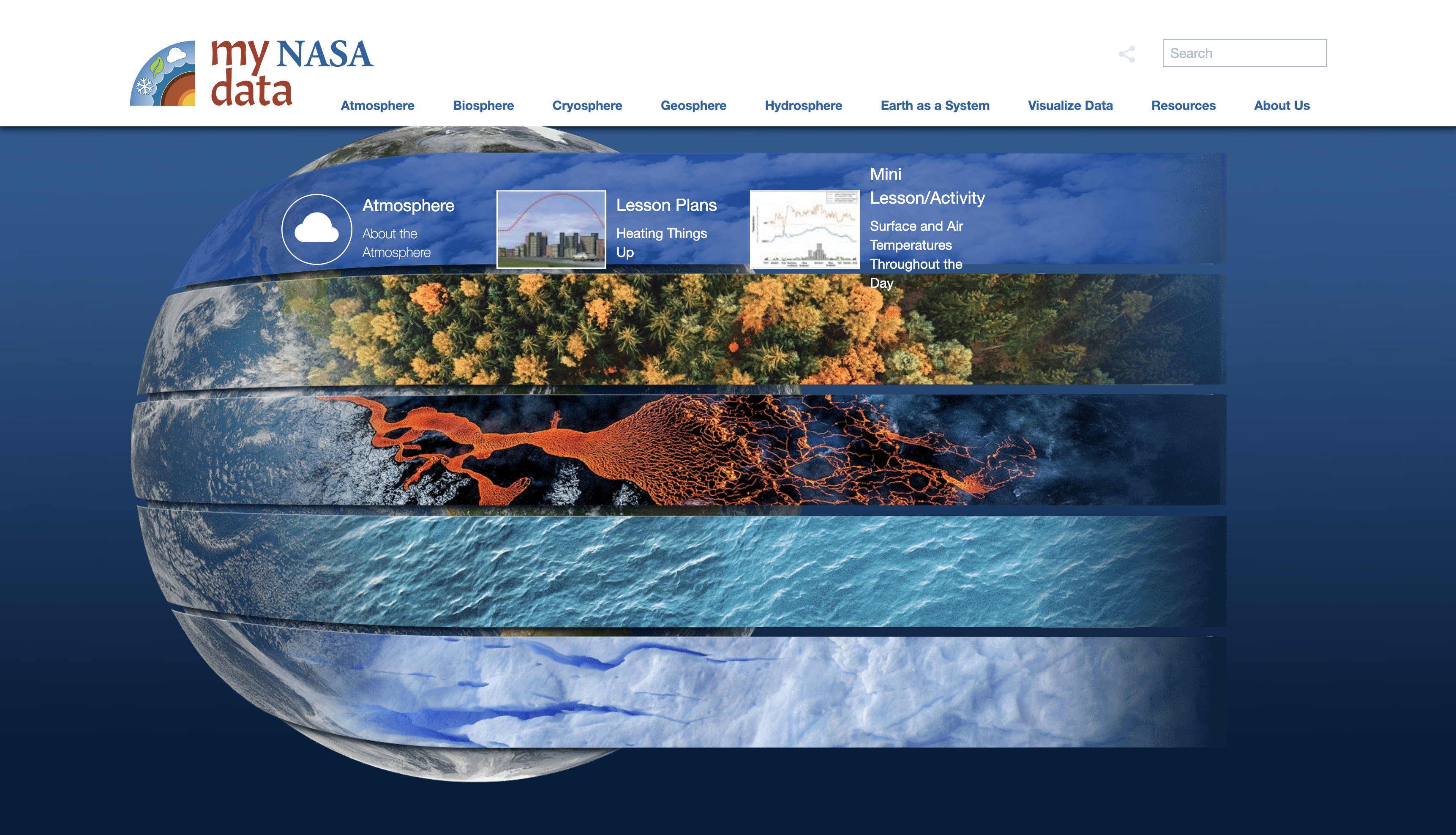
A standout feature of the My NASA Data site is the recently updated Earth System Data Explorer visualization tool. This tool provides users with access to NASA’s Earth data, allowing them to download and explore the data, then create custom data tables, graphs, and plots. This capability helps students visualize complex datasets. For example, students can compare land surface temperatures, cloud cover, extreme heat, and many other characteristics for specific locations or regions worldwide.
“The Earth System Data Explorer tool has a collection of science datasets organized by different spheres of the Earth system,” explained Desiray Wilson, a scientific programmer for My NASA Data. The program emphasizes six areas of study: atmosphere, biosphere, cryosphere, geosphere, hydrosphere, and Earth as a system. “The data goes as far back as the 1980s, and we are acquiring more daily datasets. It’s excellent for examining historical trends, regional trends, and patterns.”
Growing Popularity and Enhanced Features
The My NASA Data website saw over one million visits last year. The most frequently searched topics included temperatures, precipitation, water vapor, and air quality. This growing interest has driven continuous improvements to the platform.
Natalie Macke, a science teacher at Pascack Hills High School in Montvale, New Jersey, and a veteran educator of 20 years, has contributed to shaping the lessons on the site through internships with the My NASA Data team. Suggestions from teachers like Macke have led to enhancements in the visualization tool, such as the ability to swipe between visual layers of data and make side-by-side comparisons. Additionally, users can now click on a location to display latitude, longitude, and variable data, streamlining the previous process that required manual input of these coordinates.
“The new visualization tool is very much a point-and-click layout like our students are used to in terms of just quickly selecting data they want to see,” said Macke. “Instantaneously, a map of the Earth appears, or just the outline, and they can get the satellite view. So if they’re looking for a specific city, they can find the city on the map and quickly grab a dataset or multiple datasets and overlay it on the map to make visual comparisons.”
Building Data Literacy and Real-World Connections
Beyond creating visualizations for specific lessons, Macke emphasized the broader educational value that My NASA Data offers. The platform enables students to develop critical skills in interpreting, verifying, and using datasets in their daily lives. This skill is crucial because it fosters data literacy, helping users to analyze data critically and differentiate between assumptions and valid conclusions.
“Students can relate the data map to literally what’s happening outside their window, showing them how NASA Earth system satellite data relates to real life,” Macke explained. “Creating a data literate public – meaning they understand the context and framework of the data they are working with and realizing the connection between the data and the real world – hopefully will intrigue them to continue to explore and learn about the Earth and start asking questions. That’s what got me into science when I was a little kid.”
The Importance of Data Literacy in Education
Data literacy is becoming increasingly important in today’s world. It involves understanding how to read, work with, analyze, and argue with data. In an era where data-driven decisions are critical, these skills are invaluable. By integrating NASA’s satellite data into the classroom, students are given a unique opportunity to develop these skills early on.
The My NASA Data platform is not just about providing access to data; it’s about making that data meaningful and accessible. By offering tools that allow for the creation of visualizations and comparisons, students can see firsthand how data reflects real-world conditions and trends. This hands-on approach helps demystify complex scientific concepts and fosters a deeper understanding of Earth’s systems.
Encouraging the Next Generation of Scientists
NASA’s commitment to education through initiatives like My NASA Data is crucial in inspiring the next generation of scientists, engineers, and informed citizens. By providing educators with the resources to bring real-world data into the classroom, NASA helps spark curiosity and a passion for science among students.
As students engage with the data, they learn to ask questions, seek answers, and develop a scientific mindset. This process not only supports their academic growth but also encourages them to consider careers in science, technology, engineering, and mathematics (STEM).
Conclusion
The My NASA Data website and its Earth System Data Explorer tool are invaluable resources for educators and students alike. By providing access to NASA’s extensive collection of Earth data, these tools help bring science to life in the classroom. The platform’s user-friendly features and continuous updates ensure that it remains a relevant and powerful educational tool.
As students and teachers continue to explore and utilize these resources, the goal is to build a data-literate public that understands the importance of data in making informed decisions about our planet. By fostering this understanding, NASA is helping to prepare the next generation to tackle the challenges of the future with knowledge and confidence.
For more information, visit the My NASA Data website here and explore the Earth System Data Explorer tool here. Educators interested in joining the My NASA Data community can find more details here.
For more Information, Refer to this article.


