NASA’s Tanager-1 Satellite to Combat Climate Change
The Jet Propulsion Laboratory (JPL) at NASA has recently developed a groundbreaking imaging spectrometer that promises to deliver actionable data to help curb emissions that accelerate global warming. The first satellite from the Carbon Mapper Coalition, named Tanager-1, now orbits Earth carrying this state-of-the-art, NASA-designed instrument designed to track greenhouse gases.
Launch and Initial Operations
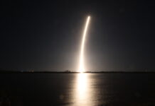
On August 16, at 11:56 a.m. PDT, Tanager-1 successfully launched aboard a SpaceX Falcon 9 rocket from Space Launch Complex 4E at Vandenberg Space Force Base in California. Ground controllers established contact with the satellite at 2:45 p.m. PDT the same day, marking the beginning of its mission to monitor and measure greenhouse gases.
Advanced Imaging Technology
Tanager-1 is equipped with an advanced imaging spectrometer developed over four decades at NASA’s Jet Propulsion Laboratory in Southern California. This technology enables the satellite to measure point-source emissions of methane and carbon dioxide on a global scale down to individual facilities and pieces of equipment. This precision is a breakthrough in the fight against climate change, providing highly detailed data that can pinpoint specific emission sources.
The Carbon Mapper Coalition
The development of Tanager-1 was led by the nonprofit Carbon Mapper, a public-private coalition that includes members like Planet Labs PBC, which built the satellite, and JPL. Planet Labs PBC and JPL are planning to launch a second Tanager satellite equipped with another JPL-built imaging spectrometer in the future.
Significant Contributions to Climate Science
Laurie Leshin, the Director of JPL, emphasized the uniqueness and importance of the imaging spectrometer technology aboard Tanager-1. "The data that this public-private partnership provides on sources of greenhouse gas emissions will be precise and global, making it beneficial to everyone," she noted.
Operational Capabilities
Once fully operational, Tanager-1 will scan approximately 50,000 square miles (130,000 square kilometers) of Earth’s surface daily. Scientists at Carbon Mapper will use data from the satellite to identify gas plumes with the unique spectral signatures of methane and carbon dioxide and pinpoint their sources. This information will be made publicly available online via the Carbon Mapper data portal.
Understanding Greenhouse Gases
Methane and carbon dioxide are the primary greenhouse gases contributing to climate change. Human activities, particularly from fossil fuels, agriculture, and waste management industries, account for about half of global methane emissions. Carbon dioxide levels in the atmosphere have increased by 50% since 1750, mainly due to the extraction and burning of coal, oil, and gas.
A Collaborative Effort
Riley Duren, CEO of Carbon Mapper, highlighted the collaborative nature of the project. "The Carbon Mapper Coalition is a prime example of how organizations from different sectors are uniting around a common goal of addressing climate change," he said. By providing data on super-emitters and making it accessible to decision-makers, the coalition aims to drive significant global action to reduce emissions.
How the Imaging Spectrometer Works
The imaging spectrometer aboard Tanager-1 measures hundreds of wavelengths of light reflected by Earth’s surface. Different compounds in the atmosphere, such as methane and carbon dioxide, absorb specific wavelengths, leaving behind spectral "fingerprints." The spectrometer can identify these infrared fingerprints, allowing researchers to pinpoint and quantify strong greenhouse gas emissions. This capability could accelerate efforts to mitigate emissions by providing precise data.
Broader Efforts and Future Plans
Tanager-1 is part of a larger initiative to make data on methane and carbon dioxide more accessible and actionable. This includes utilizing measurements from NASA’s Earth Surface Mineral Dust Source Investigation (EMIT), an imaging spectrometer developed by JPL and currently installed on the International Space Station.
About Carbon Mapper
Carbon Mapper is a nonprofit organization dedicated to facilitating timely action to mitigate greenhouse gas emissions. The aim is to fill gaps in the emerging global ecosystem of methane and carbon dioxide monitoring systems by delivering precise, timely, and accessible data to empower science-based decision-making and action. The organization leads the development of the Carbon Mapper constellation of satellites, supported by a public-private partnership. This coalition includes Planet Labs PBC, JPL, the California Air Resources Board, the University of Arizona, Arizona State University, and RMI, with funding from philanthropic organizations such as the High Tide Foundation, Bloomberg Philanthropies, and the Grantham Foundation for the Protection of the Environment.
Implications and Reactions
The launch of Tanager-1 has been met with optimism from the scientific community and environmentalists alike. The data it collects will not only bolster our understanding of greenhouse gas emissions but also provide the evidence needed to implement effective climate policies. This initiative exemplifies the power of collaboration between public and private sectors in addressing one of the most pressing issues of our time—climate change.
Conclusion
Tanager-1 represents a significant advancement in our ability to monitor and mitigate greenhouse gas emissions. Its state-of-the-art imaging spectrometer technology will provide highly precise data on methane and carbon dioxide emissions, enabling targeted action to combat climate change. As part of a broader effort led by the Carbon Mapper Coalition, this satellite is a crucial step toward a more sustainable and environmentally conscious future.
For further details, you can contact Andrew Wang or Jane J. Lee at Jet Propulsion Laboratory, Pasadena, California, or Kelly Vaughn at Carbon Mapper, Pasadena, California.
Contact Information
- Andrew Wang / Jane J. Lee
- Jet Propulsion Laboratory, Pasadena, Calif.
- 626-379-6874 / 818-354-0307
- andrew.wang@jpl.nasa.gov / jane.j.lee@jpl.nasa.gov
- Kelly Vaughn
- Carbon Mapper, Pasadena, Calif.
- 970-401-0001
- kelly@carbonmapper.org
This marks another milestone in our collective effort to understand and address the challenges posed by climate change. With initiatives like Tanager-1, we are making significant strides toward a more sustainable future.
For more Information, Refer to this article.


